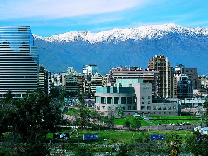
Underdeveloped desert north and cold south, and more active, with high population density. The middle part. Two thirds of the country’s inhabitants live in this territory, which favorably influences the economic development in this region. The capital Santiago is the main political, economic and socio-cultural center of the country, with a population of more than 5 million people, while all residents have about 15 million.
Along the meridians of Chile is divided into coastal territory from ancient geological plateaus, terminating to the Pacific Ocean, in the middle the surface is divided by the Longitudinal and Central valleys and further the Andes mountain ranges bordering Argentina and Bolivia. The country’s climate is very different in the Northern Deserts, Middle Chile and Southern Chile.
High Andes in the territory of Middle Chile occupy one third of the total area. They stretched for 800 km, between the two cities – Coquimbo and Concepcion.
Complicated in structure, a single line of mountains consists of volcanoes and the second highest in the western hemisphere – the peak of Ojos Del Salado. In the southwestern part of the mountain range there are active volcanoes. Peaks with a height of more than 3,500 meters are covered with non-melting snow.
The second third of the country’s area falls on the coast along the Pacific Ocean. The surface is elevated plains – a plateau of volcanic origin, separated by sharply outlined river valleys, falling from the eastern slopes of the Andes. Larger rivers – Bio-Bio and Maule create wide valleys and flow into the Pacific Ocean. There are few comfortable harbors protected by stone capes, this is impossible because of the steep, elevated coast.
Between the coastal zone and the Andean massifs lies the Longitudinal, Central Valley, broken by the slopes of the mountains and elevations into hollows, carved by rivers that originate in the mountains. The turbulent waters of the rivers bring into the valley a lot of debris and washed soil, creating a cone-shaped sediment. The western surfaces of these sediments are used as fertile arable land. Towards the north, the longitudinal valley becomes narrower and disappears, passing into coastal plateaus. Spacious fields, with poplar and willow trees growing around it, are used for growing crops, irrigating them with water from mountain rivers.
In northern Chile, from the western coastal zone, there is a desert called Atacama. The territory of 1300 km length is a sad, dry depressions, huge sediments of pebbles and soil saturated with salts. Occasionally, these landscapes are interspersed with riverbanks overgrown with plants and trees.
The largest river is Loa. The coast of the Pacific Ocean, surrounded by hills, is also inhospitable. On the grounds of the slopes, suitable narrow strip to the ocean are the port cities of Caldera, Antofagasta, Iquique. The railway, climbing the mountain slopes, connects them with the industrial development of copper ore. Saltwater, sodium nitrate and iodine salts are extracted in the foothills of the pits.
South of the plains of Central Chile gradually pass into dense forests. Farms are sometimes found here, but agriculture is poorly developed. The surface of the Central Valley is strongly divided by hills and arrays of icy detrital rocks, among which flood lakes are often found.
The Southern Andes are lower and feature the most beautiful ice valleys and peaks in the world, lakes and waterfalls.
The height of the eternal snow here goes down to 700 meters, and sometimes reaches the level of the bays and form icebergs.
The nature and climate of Chile are very diverse, due to the great length from north to south and the influence of the cold current of the Pacific Ocean. This is an amazing and beautiful country.