The Sea of Okhotsk was discovered during the first campaigns of the Cossacks through Siberia to the Pacific Ocean. Local hunting tribes called it Lam – which means: “water”, “sea”, and from this word among the Russian sailors one of the first names of the sea went – “Lamskoe”, and the name of the coastal Tungus – “Lamut”. Sometimes called the sea and the Tunguska.
However, gradually another name became known and fixed, namely the Sea of Okhotsk. The water area is 1603 thousand km².
Subsequently, when Kamchatka was discovered and trekking along the coast and the sea to this rich peninsula and to the mouth of the Penzhina river became frequent, other names for the sea began to be used – “Kamchatka” and “Penzhinskoe”. However, these names are not instilled.
It would seem, why should we give the sea a name by the name of a small river, which flows into it between 59 and 60 degrees north latitude? You can find much larger and deep rivers that flow into this sea – like the same Penzhin. Why didn’t their name get associated with the name of the sea? In this case, the matter did not depend on the size of the river, but on its role in the life of coastal researchers.
The Cossacks, having left Yakutsk, were moving to the east not straight through the mountains and taiga, but by winding paths along the rivers and the willows between them. The caravan trail led them eventually to the Hunting River, and along it to the seashore.
Now Okhotsk is one of the ordinary port points and has lost its former value. Other, much larger and more important centers appeared on the coast. But the surviving name of the sea testifies to the historical role of the river and port, from which the Russian people began to develop a large sea area.
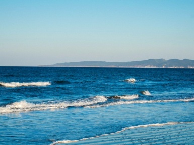
Almost everywhere the shores of the Sea of Okhotsk are high, rocky. From a distance, from the sea, they stand out on the horizon with black stripes, framed on top with brown-green patches of vegetation. Only in some places — near the western coast of Kamchatka, near northern part of Sakhalin — wide low-lying areas approach the sea.
The bottom of the Sea of Okhotsk is similar in some respects to the bottom of the Sea of Japan: here and there, despite great depths, there are underwater troughs indicating that even in the Quaternary, the area of the present sea stood high above the ocean level and two huge rivers flowed through it – Cupid and Penzhina. Then a geological catastrophe occurred – a part of the continent descended and was flooded with ocean. Thus, the relatively young Sea of Okhotsk was formed.
According to geologists, the eastern part of the Sea of Okhotsk is one of the “restless” regions of the globe. To date, there are large fluctuations – the movements of the earth’s crust. We can sense and see them from earthquakes, volcanic eruptions, changes in the shape of the islands. Often in this part of the Pacific Ocean underwater volcanic eruptions and underwater earthquakes occur. Particularly noticeable originality of the area in the Kuril Islands.
The ridge of the Kuril Islands, lying on the border between the Sea of Okhotsk and the open part of the ocean, represents a very special world. About thirty large and small islands and many rocks of volcanic origin are included in this ridge. Many islands are crowned with high mountains, up to one and a half to two kilometers in height. On many islands from under the ground hot springs are beating with a water temperature of 35 to 70 °. Some sources have healing properties. Smoke is smoked over some mountains that are active volcanoes.
There are about thirty active volcanoes on the islands. This shows that in the bowels of the earth here and now restless. Sometimes, when earthquakes in the ocean occur, waves with a height of several tens of meters, which roll for an enormous distance. In 1780, one of these waves, the ship Natalia, was abandoned inland of the Urup island 300 meters from the coast. The ship remained on land. A few words about this have been preserved: “January of the eighth. In 1780, a brutal earthquake was made, the sea rose so high that the hukor — that is, the ship standing in the harbor — was carried to the middle of the island. ”
Harsh living conditions in the Kuril Islands, especially in the north. Ocean waves noisily hit the rocky shores, breaking into millions of splashes. Water droplets picked up by the wind rush through the islands. There are long fogs. In winter, there are often strong storms. Отправить отзыв История Сохранено Сообщества