The cold Bering Sea is by no means lifeless, although there are fewer living creatures in it than in warmer waters. Nevertheless, fish are actively caught here, and numerous routes of transport vessels, and not only Russian ones, pass through the sea. True, shipping is dangerous here, and perhaps not all year round because of the harsh climate that can freeze even sea spaces.
This is the deepest of all Russian seas. With an average depth of 1600 meters, its deepest point reaches a mark of 4151 meters below sea level. Among all the seas of Russia, Beringovo is the largest. Earlier, the Bering Sea was called Kamchatka or Bobrov, and the first name was officially used by Russian cartographers as early as the 18th century. Having only about 4 km wide, the Bering Strait divides the shores of the USA and Russia.
It received its name in honor of Vitus Bering, a Dane who became commander of the Russian fleet and explored this sea in the first half of the 18th century. True, the Bering Sea was named much later. The Bering Sea area is more than 4 times larger than the area of France. Its waters wash the territories of only two countries – the USA and Russia. The north of the Bering Sea is icebound for up to 9 months a year, and in the west icebergs brought by currents occur even in August, in the warmest month of the year.
The air temperature above the surface of the Bering Sea, even on the warmest summer days, usually does not rise above + 8-10 degrees. 402 different species of fish live in the Bering Sea. It received its present name in 1818.
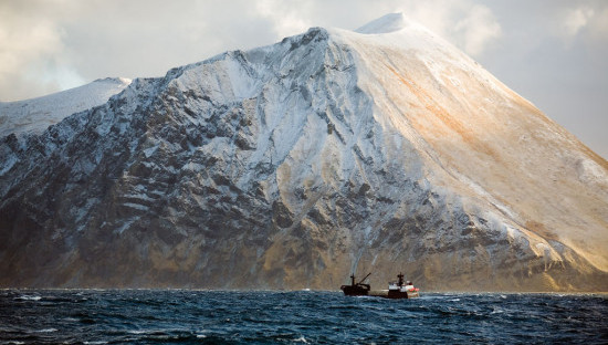
The Bering Sea is famous for protracted storms, which sometimes rage for 7-10 days in a row. This is caused by the collision of warm waters from the Pacific and the cold of the Arctic Ocean. The northern regions of the Bering Sea usually begin to freeze already in early September. Ice usually melts in May and June. The largest city on its shores is Anadyr, which is home to 15 thousand people.